One Busy Week Ahead Part I; Winter Storm and Precipitation
The active weather pattern continues. We'll start with yet another winter storm beyond the one that is now winding down in North Dakota and surrounding areas.
Here is the probability of 4" or more snow accumulation until 7am CDT on Wednesday:
And, the probability of 4 inches or more of snow from 7am Wednesday to 7am Thursday.
Here is the forecast precipitation (rain and the moisture content of the snow) for the next five days:
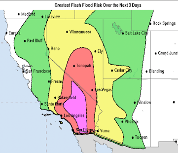
While many areas west of the Mississippi still need the moisture -- in many areas badly -- flooding may develop over parts of the Upper Midwest as indicated below.
These heavy rains will delay planting in some areas.
I'll have more about the tornado and severe thunderstorm potential later this morning.


April showers bring may flowers :) Hard to complain when we need the moisture - from the maps you are presenting it looks like much of the areas getting hit need it.
ReplyDelete